
Khao Sok Rainforest & Cheow Lan Lake Region
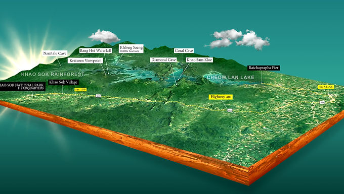
A regional 3D diagram showing Khao Sok village, national park headquarters, Highway 401 and Cheow Lan Lake.
From Khao Sok Rainforest to Cheow Lan Lake
Travellers often hear the names Khao Sok National Park and Cheow Lan Lake used together, which can make them sound like a single arrival point. In practice, the rainforest village area and the lake are separate gateways connected by road. Understanding that distinction is one of the most useful things to know before planning a visit.
This regional illustration brings the main elements into one view: Khao Sok Village, the National Park Headquarters, Highway 401, Ratchaprapha Pier and selected attractions around the reservoir. It shows the change from a land-based rainforest experience to a lake journey that continues by longtail boat.
For example, a traveller may spend the first part of a trip exploring forest trails near the village, then travel east by road to Ratchaprapha Pier for a lake excursion or overnight stay. Once on the water, places such as Khao Sam Kler, Pakarang Cave and the floating resorts become part of a different network of boat routes and activity stops.
The map is especially useful as a first step before using our journey planner. It helps you think about transfers, activity time and accommodation as connected parts of the same trip. Place labels and distances shown on the illustration should be treated as approximate until verified against current local information.